
Sponsors: ♦ Wu Style Taichi (吳家太極拳) ♦
About us
HK intro
Easy Walk
River
Hiking
Coastine
Caving
Overseas
Gallery
Join us
Hiking tips
Other sites
Publicity
Contact us
Outdoor Doctor
FaceBook Group
Order FREE HK Travel Brochure!
Visitors
since April 2000
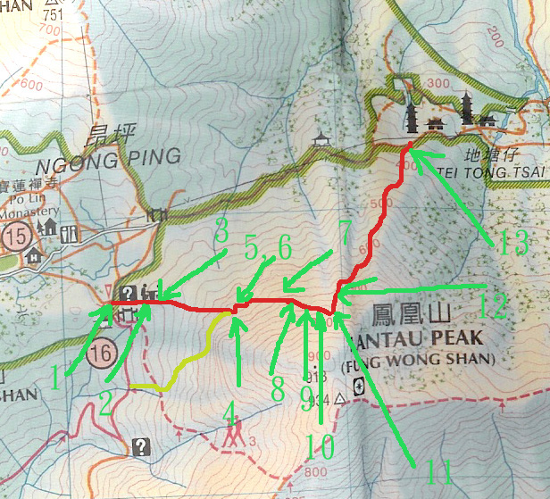
White Jaw Lower Path (白顎下棧道)
Difficulty:

Last Visit: 9 Apr 2007
Lantau
Trip Description
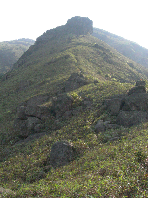
This is an old path opened up by hikers to connect many different hiking spots of the Lantau Peak. One end starts at the end of the very famous “Meandering Stone River” (倒腕石河) (indicated in yellow on the map), the longest stone rivers in Hong Kong where an accident happened in early 2007. The Meadering Stone River can also access to the middle stream of Feng Bi Stream . The other end finishes at the Lo Hon Tower (羅漢塔) where two routes join: the two routes are the stream of North Heavenly Gate (北天門) on the west side of Lo Hon Tower and a uphill path on the east side of Lo Hon Tower.
|
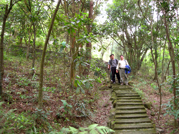
Location 1: Altitude 430MIt starts exactly at a gate called Tung Shan Fat Mum (or East Hill Budda Way), which is a point along the old path connecting to Tei Tong Tsai (地塘仔). You can also see a sign of camping site there. Walk in the camping site.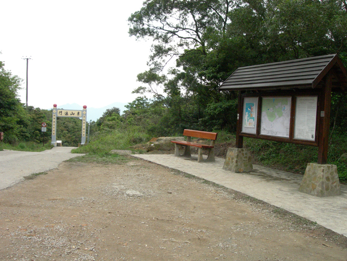 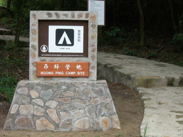 |
Location 2: Altitude 470M
|
Location 3: Altitude 500M
|
Location 4: Altitude 655MWhen you walk more uphill, you hardly find any clear path. But the path actually leads you move to your left side (West) when you go uphill. If you still walk straight uphill, you will find the slope steeper and steeper and this is not advisable, and even move into “Meandering Stone River” if you deviate to your right side (East). When you reach around 650m, start to look on your left side and the path gets narrower and finally you go into brushes.
|
Location 5: Altitude 660M
|
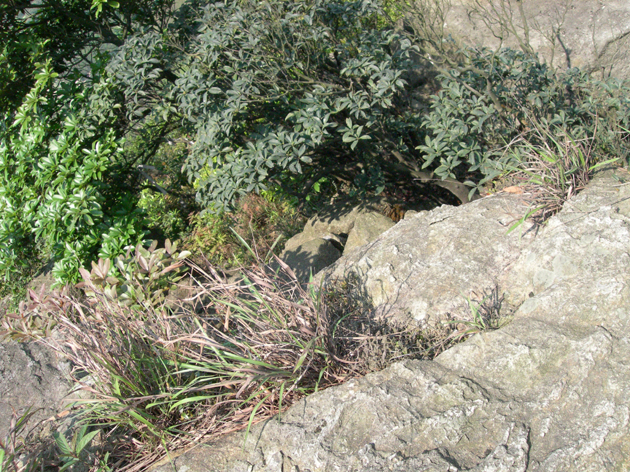
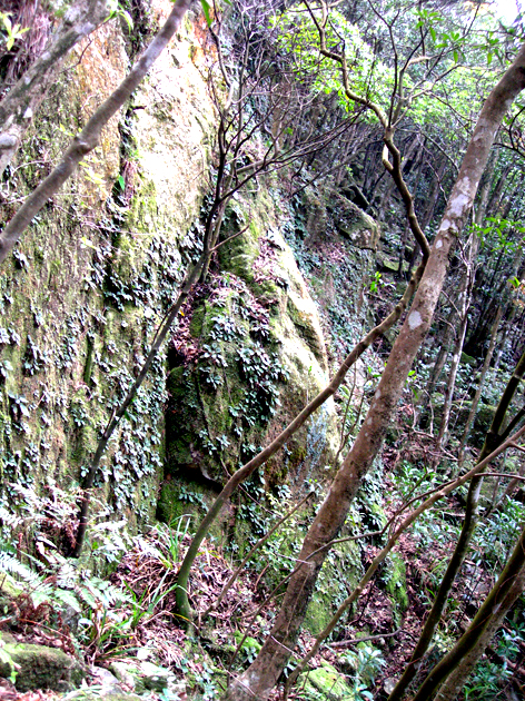
Location 6: Altitude 665MWalking for only 1-2 minutes, you will find yourself in a forest. You may lose your orientation when you enter the forest. Always remember the location of the big stone and cliff.
There is the safety rule in the forest. Remember, down this forest is the hanging cliff (which is the White Jaw). Once you go into the forest, keep in mind that you need to continue to climb upward to 700m. If you only go downhill a bit, that is ok. But if you go down below 600m inside the forest, you will find yourself on the edge of a hanging cliff. It is very dangerous.
|
Location 7: Altitude 650M
|
Location 8: Altitude 710M
|
Location 9: Altitude 715M
|
Location 10: Altitude 745M
|
Location 11: Altitude 745MAfter the Mao Kui Shi, then you will see a bigger stone like a smaller Lo Hon Tower. But it is not Lo Hon Tower. Instead, you can see besides the stone a “dripping water cliff wall”, which is really huge! It is just like going into another world at this place.
|
Location 12: Altitude MYou reach Lo Hon Tower. This is the end of the Lower Jaw Lower Path. At this point, we choose to walk down the peak by the footpath. Then you have to choose to go down on your left side.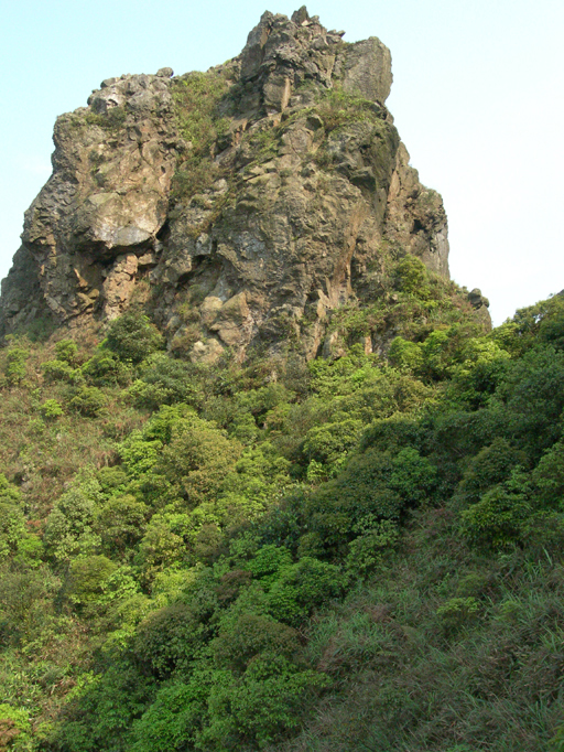 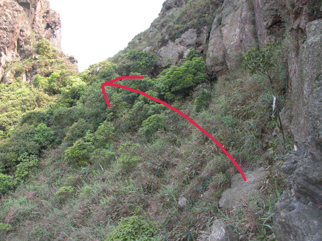 |
Location 13: Altitude 775M
|
Location 14: Altitude 725M
|
Location 15: Altitude 330M
|


|
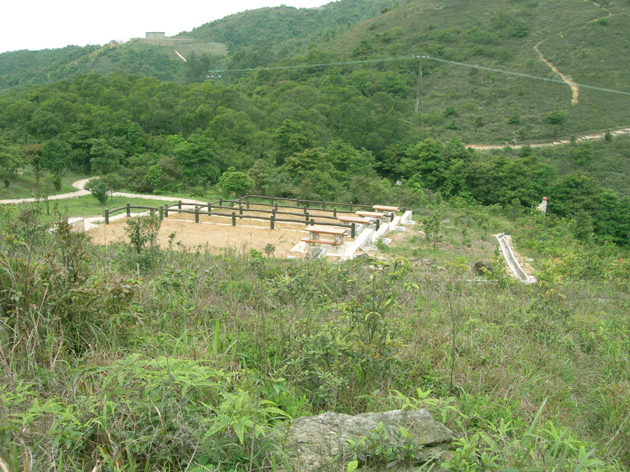 Looking back to the camping site.
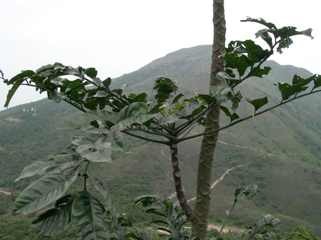 Looking to the south side you can also see Nei Lak Shan (彌勒山) clearly.
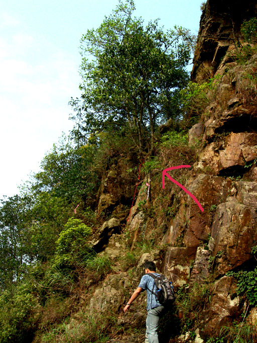
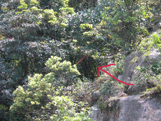 You start to see indicator (red ribbon) leading you into a forest. That is the start of the While Jaw Lower Path. Occasionally, you will see hikers coming suddenly from your (East) side when they finish the “Meandering Stone River”.
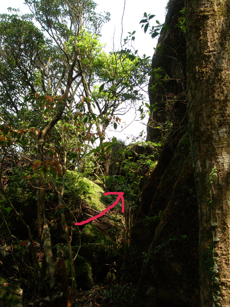
 This is the scene of the forest during my exploration
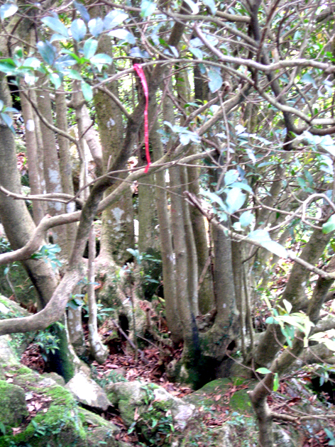 Look at these straight trees where you can see red ribbons. In fact, inside the forest, if you follow the right path, there are also white ribbons along. This is the exit of the forest.
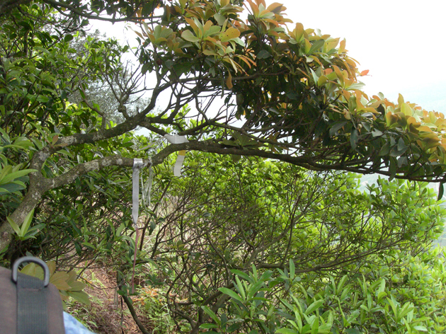 When you walk out the forest, you can see a clear footpath with white ribbons hanging on trees. When you are on the path, you can see also the Po Lin Temple and the Big Budda.
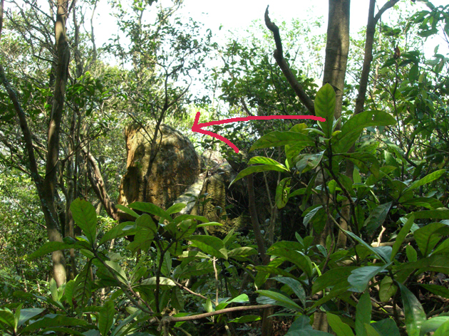
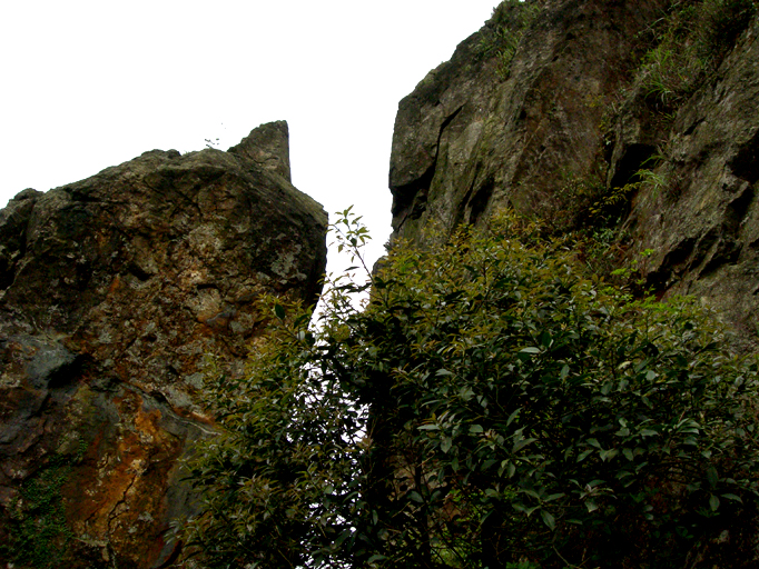 The flat footpath will lead your way going around Lautau Peak. And soon you will see the “Stone of the Animal tail helmet” (Mao Kui Shi) (旄盔石). The small stone on the top of the big left stone looks like a feather, tail or a crown. You have to go into the gap between the big stone and the cliff. Many people behave like a spider walking up the stone inside the gap.
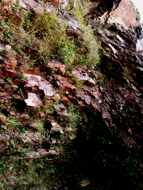
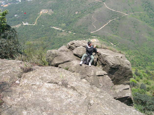
 A Photo taken on the bottom of Lon Hon Tower.
 A path leading downward. Looking back is the Lo Hon Tower.
 It is the exit to the path at Tei Tong Tsai.