
Sponsors: ♦ Wu Style Taichi (吳家太極拳) ♦
About us
HK intro
Easy Walk
River
Hiking
Coastine
Caving
Overseas
Gallery
Join us
Hiking tips
Other sites
Publicity
Contact us
Outdoor Doctor
FaceBook Group
Order FREE HK Travel Brochure!
Visitors
since April 2000
Wang Leng (橫嶺)
Difficulty:

Last Visit: 26 Dec 2000
NT North
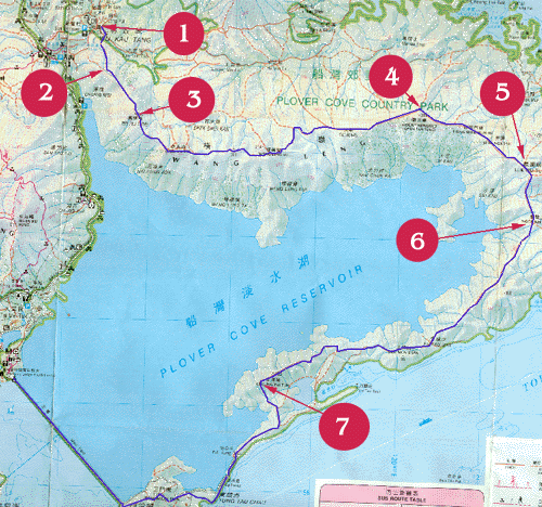
Trip DescriptionThis is a very good sight-seeing trip but it can easily take you 7 hours to complete. The route basically brings you across the ridges among the mountains. The route encompasses Plover Cove Reservoir(船灣淡水湖). Prepare sufficient water and food for this trip. There is no shelter on the ridges, the route could be demanding under the burning Sun. Ah, one more thing, bring a torch with you lest it should get dark before you come out. |
Location 1: Altitude 100M
|
Location 2: Altitude 180M
|
Location 3: Altitude 295M
|
Location 4: Altitude 260M
|
Location 5: Altitude 280M
|
Location 6: Altitude 155M
|
Location 7: Altitude 125M
|


|
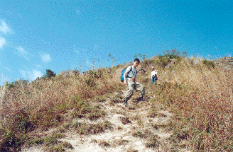
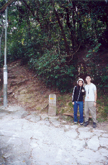 This is the entrance at Wu Kau Tang(烏蛟騰). You can easily find a footpath behind the stone post.
 After 10 to 15 minutes, you would be on the Wang Leng ridge hiking trial.
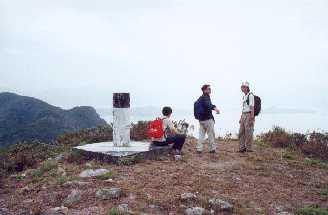 This is called Ma Tau Fung(馬頭峰).
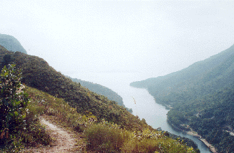
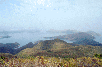 This picture was taken from Mount Newland(觀音峒). The beautiful sea is Yan Chau Tong Marine Park(印洲塘海岸公園).
 This slope is the famous Luk Wu Tung(鹿湖峒). Hikers give it a nick of Falling Dog(跌死狗). As its name suggests, this slope is very steep. Mind your steps.
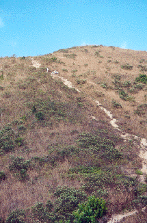 Another steep slope you will encounter is in Ngor Kai Teng(鵝髻頂).
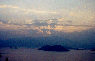 This beautiful sun set was taken at Cheung Pai Tun(長牌敦). You can see the dam of the reservoir lying across.