
Sponsors: ♦ Wu Style Taichi (吳家太極拳) ♦
About us
HK intro
Easy Walk
River
Hiking
Coastine
Caving
Overseas
Gallery
Join us
Hiking tips
Other sites
Publicity
Contact us
Outdoor Doctor
FaceBook Group
Order FREE HK Travel Brochure!
Visitors
since April 2000
Pok To Yan (泊刀屻)
Difficulty:

Last Visit: 16 Dec 2001
Lantau

Trip Description
Pok To Yan is a medium long ridge runs from Tung Chung towards the centre of Lautau Island. Pok To Yan's ridge is not as sharp as that of Dog Teeth Range. The slope on the west end of Pok To Yan is quite steep and strenuous. The picture on the right captures the whole view of Pok To Yan.
|
Location 1: Altitude 140M
|
Location 2: Altitude 230M
|
Location 3: Altitude 395M
|


|
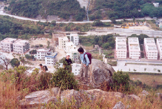 We are now struggling on the steep slope on the west of Pok To Yan. The background of the photos is Ma Wan New Village.
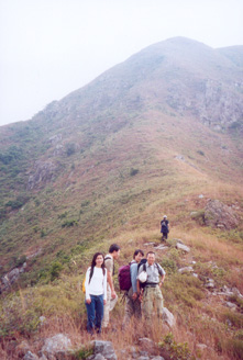 We are now about to overcome the steepest face of Pok To Yan.
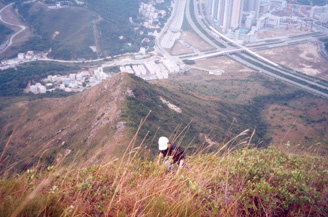 The lady in the picture has nearly finished the steepest portion of Pok To Yan. After this point, the path begins to flatten off. Hikers will eventually meet other major trails.