
Sponsors: ♦ Wu Style Taichi (吳家太極拳) ♦
About us
HK intro
Easy Walk
River
Hiking
Coastine
Caving
Overseas
Gallery
Join us
Hiking tips
Other sites
Publicity
Contact us
Outdoor Doctor
FaceBook Group
Order FREE HK Travel Brochure!
Visitors
since April 2000
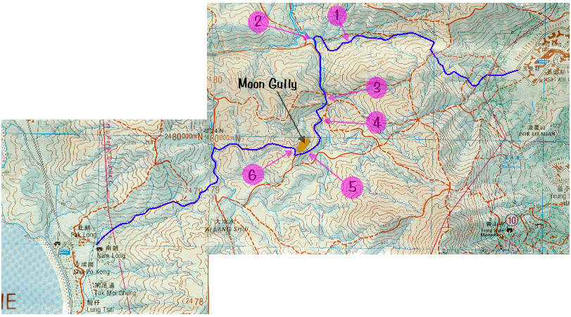
Moon Gully(月牙谷)
Difficulty:

Last Visit: 21 April 2002
NT West
Trip Description
The Castle Peak area is an area of bald. It does not bear dense forest as many other mountain ranges do. During the Japanese occupation of Hong Kong in WWII, Japanese troop came here and harvested the wood for construction. The land was then deforestized. Half a century later, this naked area has been severely eroded. Forest has gone, gullies and sandy soil have left.
|
Location 1: Altitude 75M
|
Location 2: Altitude 30M
|
Location 3: Altitude 100M
|
Location 4: Altitude 160M
|
Location 5: Altitude 185M
|
Location 6: Altitude 240M
|


|
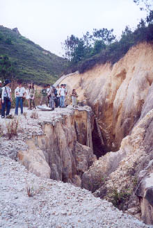 As we talked towards the middle stream of Qing Dai stream, some deep wide cracks showed up.
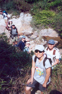
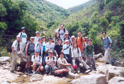 Here we met the Qing Dai Stream and began to hike along the stream. Since there is no resident in the upper stream, Qing Dai Stream is a pretty clean water system.
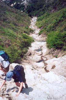 We are now the top of Four Stacking Pools of Qing Dai Stream.
 Now we leave the stream and start our search for Moon Gully.
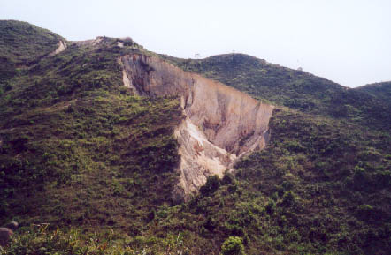 Here it is! The Moon Gully.
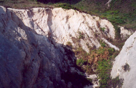 This picture was taken at the upper end of the Moon Gully.