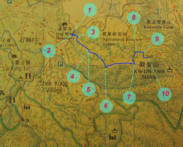
Kwun Yam Shan (觀音山) is a very steep hill. Most people go there by a well-paved cement road. An alternative is to go through remote muddy path and the rock river from the west side of the hill. The muddy path is short and yet it is packed with excitments. It is definitely not for the faint-hearted causal hikers.
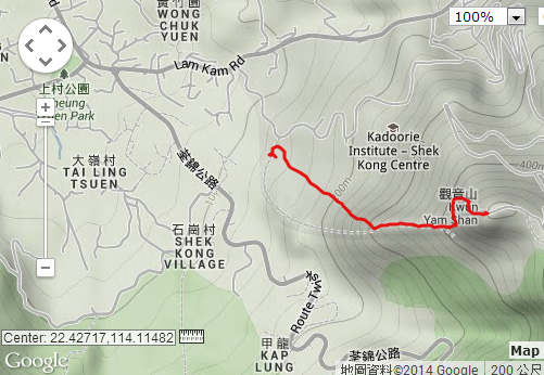
The rock river is one of the highlight of the trip. The red arrow is pointing the rough location of the rock river.
Location 1: Altitude 130M
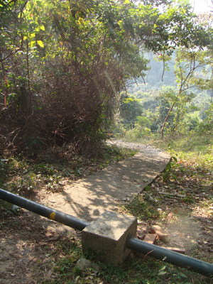
There is a small pavement branching out from the main road. This is the starting point.
Location 2: Altitude 125M
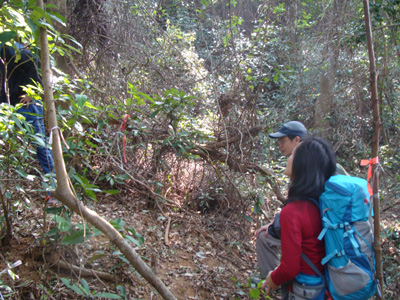
Very soon you come aross a thin stream. And you will find it very hard to follow the path shown in countryside map. The path shown on the countryside map may have been totally submerged by dense vegetation. So we gave up following the countryside map, instead we decided to trek up the stream guided by ribbons. There are many pipes laid along the stream.
Location 3: Altitude 135M
Just a couple of meters away, the ribbons led us into the muddy path on the right of the stream. This muddy path is not indicated in the countryside map at all. Yet this path is quite wide and easy to follow. It is just a bit steep.
Location 4: Altitude 180M
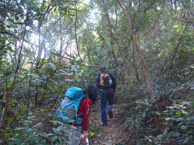
We are now dashing along the muddy path.
At about 180M, we reached a power transmission tower which is a good land mark for you to locate yourself.
Location 5: Altitude 185M
You will find junction here. Pick the uphill one which is pointing to the East.
Location 6: Altitude 310M
Here you will join the footpath from another mountain ridge.
Location 7: Altitude 415M
Now, we arrived at a the T-junction where you will find water pipe lying across. The graffiti on the pipe tell you the direction.
Location 8: Altitude 395M
Just follow the pipe which lead you downhill a bit towards North.
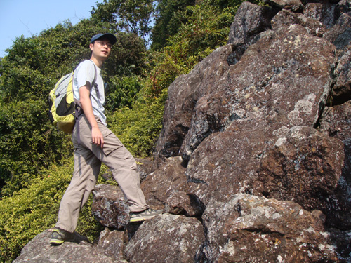
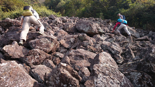
Here we go. We reached the rock river.
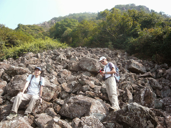
This rock river is not very long. It is about 20M long but it is steep. Great care should be exercised when you scale up. Don't get your feet stuck in the seams.
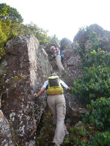
After the rock river, we reach a forest. The path in the forrest is very steep with loose sand/mud. Don't climb up in a line, the guy before you may accidentally trigger a falling rock!
Location 9: Altitude 460M
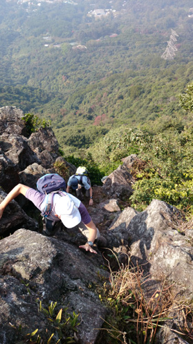
Very soon, you will take sharp 90 degree turn to the right and will find something like this. This is the last challenge of this trip. This rocky structure is not terribly difficult but there is absolute no margin for error.
Challenges came with excellent view too.
Location 10: Altitude 525M
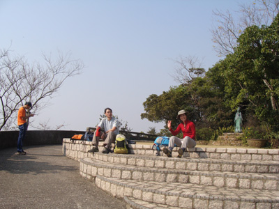
Finally, we got the top which has a Kwun Yin Statue (觀音像) in a small and peaceful terrace.


 Kwun Yam Shan (觀音山) is a very steep hill. Most people go there by a well-paved cement road. An alternative is to go through remote muddy path and the rock river from the west side of the hill. The muddy path is short and yet it is packed with excitments. It is definitely not for the faint-hearted causal hikers.


 Very soon you come aross a thin stream. And you will find it very hard to follow the path shown in countryside map. The path shown on the countryside map may have been totally submerged by dense vegetation. So we gave up following the countryside map, instead we decided to trek up the stream guided by ribbons. There are many pipes laid along the stream.
 Just a couple of meters away, the ribbons led us into the muddy path on the right of the stream. This muddy path is not indicated in the countryside map at all. Yet this path is quite wide and easy to follow. It is just a bit steep.
 You will find junction here. Pick the uphill one which is pointing to the East.
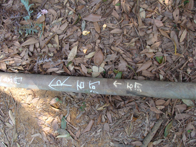 Now, we arrived at a the T-junction where you will find water pipe lying across. The graffiti on the pipe tell you the direction.
 Finally, we got the top which has a Kwun Yin Statue (觀音像) in a small and peaceful terrace.