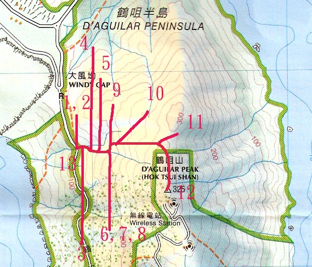
Trip Description
Hok Tsui Stream is located at the left side of the Hok Tsui Peninsula. It is not a popular road for hikers but it is a popular route for illegal immigrants to find and log Buddha Pine. So, be careful and don’t go there alone. Near the River, there are numerous paths opened up. We believe that these were routes made by the illegal immigrants. Yet, along the main path, you can see ribbons left by hikers. The current description here is a round-trip of the stream with beautiful scenery.
|
Location 1: Altitude 125M
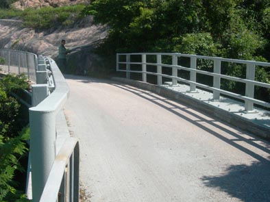 There is no public transportation to go along D’Aguilar Road. You can take the Shek O Bus and get off at Windy Gap and walk south to the entrance (a bridge) There is no public transportation to go along D’Aguilar Road. You can take the Shek O Bus and get off at Windy Gap and walk south to the entrance (a bridge)
|
Location 2: Altitude 125M
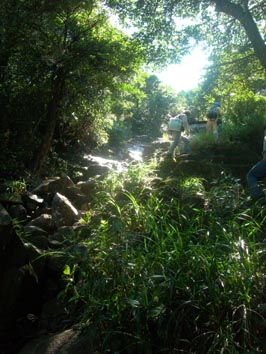
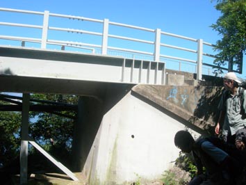 Go into the Stream on the north side of the bridge. Go into the Stream on the north side of the bridge.
|
Location 3: Altitude 130M
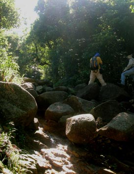 There are big boulders near the entrance There are big boulders near the entrance
|
Location 4: Altitude 140M
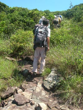
 Around this attitude, you have to walk on the right side of the stream. And you can also slowly climb up steep slopes. Around this attitude, you have to walk on the right side of the stream. And you can also slowly climb up steep slopes.
|
Location 5: Altitude 160M
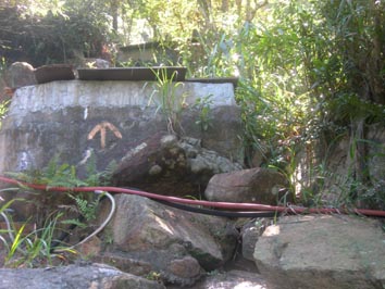 There is a man-made feature there. It is supposed to be a water storage pool. And there is an arrow on it, reconfirming your route. There is a man-made feature there. It is supposed to be a water storage pool. And there is an arrow on it, reconfirming your route.
|
Location 6: Altitude 180M
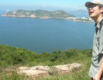 The path goes out of the brushes. You can see the scenery across the bay. It should be noticed that you are no longer in the stream because it is too dark and small. There is no water at this point. The path goes out of the brushes. You can see the scenery across the bay. It should be noticed that you are no longer in the stream because it is too dark and small. There is no water at this point.
|
Location 7: Altitude 180M
 You will end up in an open space. There are many roads here. Look left and you can find small paths. You will end up in an open space. There are many roads here. Look left and you can find small paths.
|
Location 8: Altitude 180M
 Again it leads you to a small rocky road. Again it leads you to a small rocky road.
|
Location 9: Altitude 190M
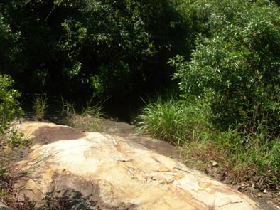
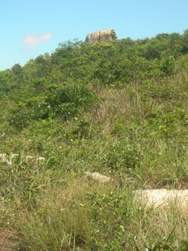 Maybe you start to be confused by many small paths. Walk to the direction of that strange flat rock on the top of the hill. Maybe you start to be confused by many small paths. Walk to the direction of that strange flat rock on the top of the hill.
|
Location 10: Altitude 200M
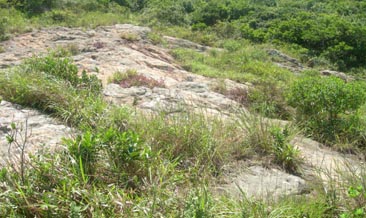 There is a flat barren of rock in front of you. Again, look left and begin to turn back. Always remember the path is on your left side where you can find some red ribbons. However, you will find yourself stuck among brushes and long grass. You have no choice but cut your way through. There is a flat barren of rock in front of you. Again, look left and begin to turn back. Always remember the path is on your left side where you can find some red ribbons. However, you will find yourself stuck among brushes and long grass. You have no choice but cut your way through.
|
Location 11: Altitude 300M
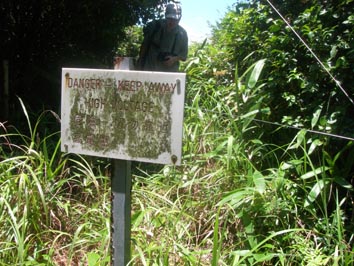 At this point you start to turn south, and then you will hit a sign warning you the danger of electric wires. Don’t go into the fences. But just walk along the fences. At this point you start to turn south, and then you will hit a sign warning you the danger of electric wires. Don’t go into the fences. But just walk along the fences.
|
Location 12: Altitude 325M
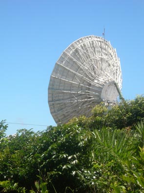 At this point you can see a large dish of the wireless station in front of you. From the station you can choose to walk along the car road of the station back to the entrance of the stream but it will be very long. Our group chose to go back along the brushes and go into the stream again. At this point you can see a large dish of the wireless station in front of you. From the station you can choose to walk along the car road of the station back to the entrance of the stream but it will be very long. Our group chose to go back along the brushes and go into the stream again.
|
Location 13: Altitude 130M
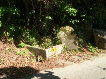 We ended up going downhill and hit the road near the drainage CD9. We ended up going downhill and hit the road near the drainage CD9.
|


|