
Sponsors: ♦ Wu Style Taichi (吳家太極拳) ♦
About us
HK intro
Easy Walk
River
Hiking
Coastine
Caving
Overseas
Gallery
Join us
Hiking tips
Other sites
Publicity
Contact us
Outdoor Doctor
FaceBook Group
Order FREE HK Travel Brochure!
Visitors
since April 2000
Tsak Yue Wu (Carp Lake) Stream (鯽魚湖石澗)
Difficulty:

Last Visit: 6 July 2003
NT East
Trip DescriptionTsak Yue Wu (Carp Lake) Stream locates in Sai Kung area. Its entrance is right next to Pak Tam Road (北潭路). It embraces many medium-to-small sized water pools. It is however, most of its pools (not all) harbour significant number of algae. Its appearance in wet seasons and dry seasons varies a lot. |
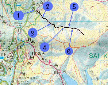
Location 1: Altitude 20MThe entrance of the stream lies under a bridge on Pak Tam Road. There is a faint footpath leading you from the bridge to the waterfront of the Tsak Yue Wu stream. The lower stream of the stream is rather fettering.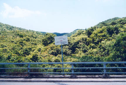 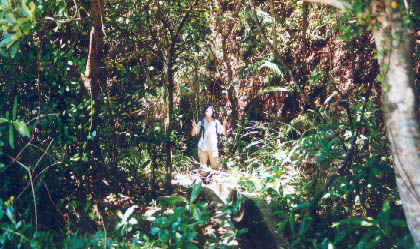 |
Location 2: Altitude 30M
|
Location 3: Altitude 45M
|
Location 4: Altitude 80M
|
|
Location 5: Altitude 100M
|
Location 6: Altitude 110M
|


|
 This is a mid-sized water pool in lower stream, it accommodates many fish and is almost algae free.
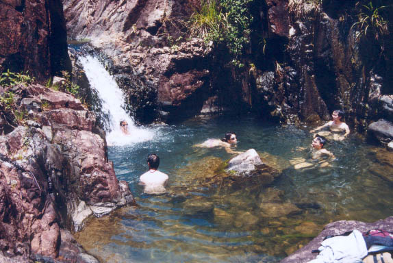 This pool looks very compromising but there is a lot of healthy algae. Under the fierce summer sun, you just have no choice but to dip.
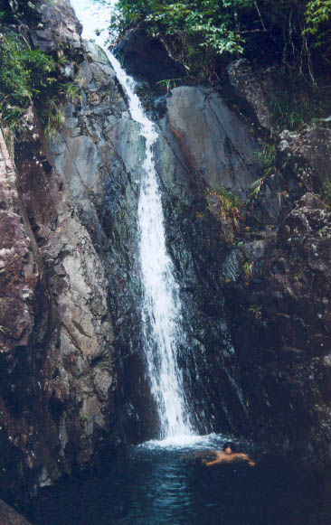 It is a rather tall waterfall, actually it is the tallest waterfall in this stream. This waterfall vanishes in dry seasons. The water pool under the waterfall is comparatively small. The pool has only about 2M deep. At this point, it seems no way to get to the top of the waterfall. Don't worry, there is always a way out.
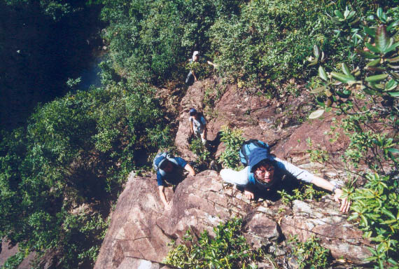 Step back a bit and you will find a ladder-like cliff on your left. Take this ladder to reach the top of the waterfall.
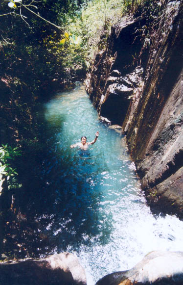
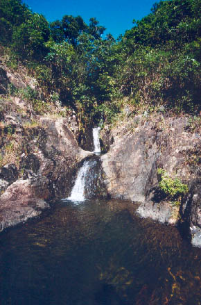 Here you will find two small water pools connected by a short waterfall. The upper pool is cool, deep and dark. Even with the aid of strong noon sunlight, you just have no idea how deep the upper pool is.
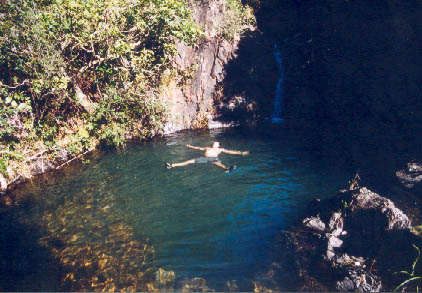 At this point, you will encounter a relatively large and clean pool. This is the last sizable water pool in the stream. It is probably the cleanest one as well.